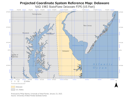
This week's lab was an exploration into coordinate systems and projections. For the final portion of the lab, we were required to select a region of intertest anywhere in the contiguous United States and select the appropriate coordinate system for it. We were then required to create a map layout with girdlines to show our location in both a projected coordinate system and a geographic coordinate system.
For my region, I chose my home state of Delaware. With this area of interest being quite small, the most appropriate projected coordinate system would be the NAD 1983 StatePlane 0700 FIPS (US Feet). Our goal is accuracy and with this projection being created with a specific focus on this locale, it would be the representation with the least amount of distrtion. This StatePlane coordinate system is a planar coordinate system and a transverse Mercator projection. It utilizes a Mercator projection due to the narrow stature of the state.

Comments
Post a Comment